


The Scottish Government’s resilience operation is in effect following a Met Office Red warning for gales of up to 100mph in Shetland.
As most of the country is starting to get back to normal after being battered in the early hours by Storm Gertrude, the Scottish Government Resilience Room (SGoRR) has been updating Ministers that the worst is set to come for the far north this afternoon.
And the whole of Scotland is set for a weekend of further weather disruption with snow, ice and more gale force winds on the way.
Deputy First Minister John Swinney said:
“The conditions we saw early this morning were largely consistent with the Amber and Yellow warnings issued earlier by the Met Office, and this advice served us well.
“We did see a significant impact on the morning commute with several road closures, restrictions on some bridges and disruption to public transport, with every effort being made to return to normal as soon as is safe to do so.
“However, this is obviously a rapidly changing picture and I would urge people to continue to check the situation before travelling today, as well as over the weekend now that we have been advised further bad weather is on the way.
“Our focus is now on working with partner agencies to minimise the impact of the severe storms set to hit the far north this afternoon, particularly Shetland.
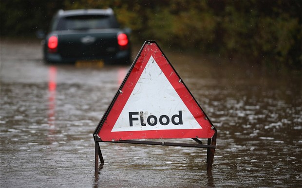
“There are a number of flood warnings in place and this obviously comes so soon after the extreme flooding experienced in parts of Scotland in recent weeks, so we will be doing all we can to ensure people heed those warnings and take appropriate measures and I will be in continual contact with our resilience team throughout.”
The rare Red alert from the Met Office is the highest category of National Severe Weather Warning.
Paul Gundersen, Chief Operational Meteorologist, said:
“We have issued a red ‘take action’ wind warning for Shetland. This means that widespread disruption to travel and other services is likely.
“Anyone in the affected should consider changing their plans and avoid dangerous areas.
“Red means you need to take action to keep yourselves and others safe from the impacts of the weather.”
Ingrid Gall, Chair of the Shetland Emergency Planning Forum , added:
“Shetland’s Emergency Planning Forum has met this morning and local agencies are preparing for all eventualities. Local transport links are already affected – Shetland Islands Council’s website is being regularly updated; you can find that information on www.shetland.gov.uk.”
The latest update from the Met Office consists of a number of Yellow and Amber warnings for snow, ice and wind over the weekend. Full details can be found on the Met Office website.
Forecasters expect a brief respite on Sunday before a return to stormy conditions on Monday and Tuesday.
Environment Minister Dr Aileen McLeod said:
“With widespread weather warnings and alerts for heavy rainfall across Scotland, localised flooding is possible in a number of areas – especially where rain is falling onto already saturated ground.
“I urge people to check their flood risk, prepare for flooding. This can easily be done by monitoring SEPA’s Floodline website for the latest flood information and signing up to get Floodline warnings direct to a mobile phone.”